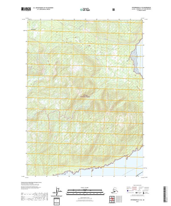
2021 Map of Petersburg B-3 SE
USGS Topo · Published 2021About this map
The Tongass National Forest dominates this coastal Alaska landscape, characterized by steep elevations and intricate waterways within the Wrangell borough. A network of primitive pathways, including the Vial Divide Trl, Mustang Lake Trl, and Vial Pass Trl, provides inland access through the dense terrain between Nesbitt Ridge and the shoreline. The mapping highlights the intersection of land and sea where the Stikine Strait meets the coast at Meter Bight. These features suggest a landscape primarily used for maritime navigation and rugged backcountry recreation, with landmarks like Muskeg Mama and St Johns serving as reference points for those traversing this coastal wilderness. The absence of traditional town centers emphasizes the area's role as a natural resource and conservation zone.
Find a feature on this map
20 named features on this map. Tap any name to fly to it.
Don’t see what you’re looking for? This feature index may not catch every label — zoom into the map to look around manually.
Map Details
Editions of this 2021 Petersburg B-3 SE Map
This is the sole edition of this map. No revisions or reprints were ever made.
Other maps of this area

1948 · Petersburg A-2
USGS Topo · 1:63,360

1948 · Petersburg B-2
USGS Topo · 1:63,360

1948 · Petersburg B-3
USGS Topo · 1:63,360

1949 · Petersburg A-3
USGS Topo · 1:63,360

1951 · Petersburg B-3
USGS Topo · 1:63,360

1952 · Petersburg
USGS Topo · 1:250,000

1953 · Petersburg A-3
USGS Topo · 1:63,360

1953 · Petersburg A-2
USGS Topo · 1:63,360

1953 · Petersburg B-2
USGS Topo · 1:63,360

1960 · Petersburg
USGS Topo · 1:250,000