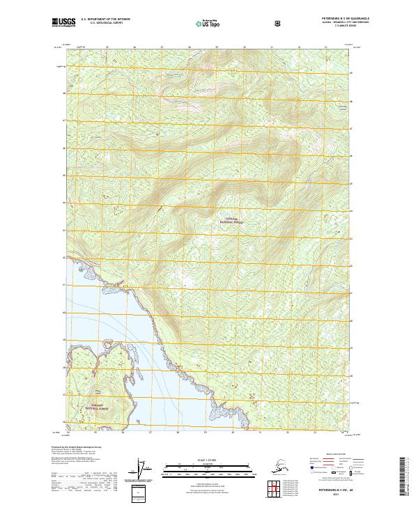
2021 Map of Petersburg B-3 SW
USGS Topo · Published 2021About this map
Zarembo Island dominates this maritime landscape within the Tongass National Forest, where steep coastal ridges give way to the deep waters of the Clarence Strait. The southwest portion of the island is marked by significant topographical relief, including the prominent Nesbitt Ridge and the secluded Mustang Lake. Coastal navigation is defined by the narrow Snow Passage and Ossip Channel, which separate the main island from smaller landmasses like Bushy Island. A network of forest management routes, such as Zarembo West, Upper Outback Down, and Lower Outback Run, provides access to the interior timberlands. This recent survey captures the modern road infrastructure and coastal landmarks like Macnamara Point at the shoreline's edge, documenting the balance between industrial access and the preserved wilderness of Southeast Alaska.
Find a feature on this map
21 named features on this map. Tap any name to fly to it.
Don’t see what you’re looking for? This feature index may not catch every label — zoom into the map to look around manually.
Map Details
Editions of this 2021 Petersburg B-3 SW Map
This is the sole edition of this map. No revisions or reprints were ever made.
Other maps of this area

1948 · Petersburg B-3
USGS Topo · 1:63,360

1949 · Petersburg A-3
USGS Topo · 1:63,360

1949 · Petersburg A-4
USGS Topo · 1:63,360

1949 · Petersburg B-4
USGS Topo · 1:63,360

1951 · Petersburg B-4
USGS Topo · 1:63,360

1951 · Petersburg B-3
USGS Topo · 1:63,360

1952 · Petersburg
USGS Topo · 1:250,000

1953 · Petersburg A-4
USGS Topo · 1:63,360

1953 · Petersburg A-3
USGS Topo · 1:63,360

1960 · Petersburg
USGS Topo · 1:250,000