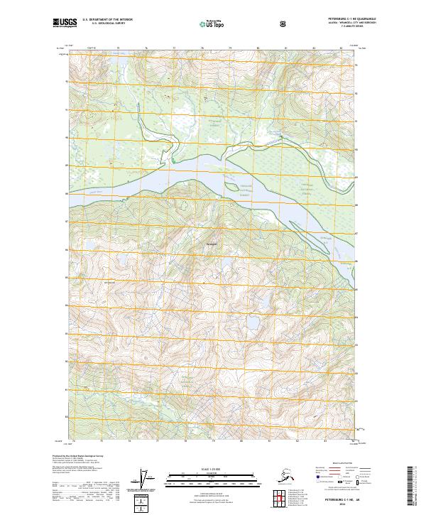
2024 Map of Petersburg C-1 NE
USGS Topo · Published 2024About this map
Stikine River dominates this portion of the Stikine-LeConte Wilderness as it flows through the Tongass National Forest near Wrangell. This modern 2024 survey documents the complex delta-like hydrology of the region, where the Kettle River and Shakes Slough branch through the floodplain. A significant geographic landmark, Chief Shakes Hot Springs, is located along the northern banks of the Kettle River, reflecting the geothermal character of this remote coastal landscape. To the west, the terrain rises sharply toward the peak of Mt Stinenia, while drainage from Shakes Lake feeds into the river system. The map provides a precise contemporary record of these protected lands and the waterways that define the historical transport corridors of the region.
Find a feature on this map
16 named features on this map. Tap any name to fly to it.
Don’t see what you’re looking for? This feature index may not catch every label — zoom into the map to look around manually.
Map Details
Editions of this 2024 Petersburg C-1 NE Map
This is the sole edition of this map. No revisions or reprints were ever made.
Other maps of this area

1948 · Petersburg C-1
USGS Topo · 1:63,360

1951 · Bradfield Canal
USGS Topo · 1:250,000

1952 · Petersburg
USGS Topo · 1:250,000

1953 · Petersburg C-1
USGS Topo · 1:63,360

1954 · Bradfield Canal
USGS Topo · 1:250,000

1955 · Bradfield canal D-6
USGS Topo · 1:63,360

1955 · Bradfield canal C-6
USGS Topo · 1:63,360

1955 · Bradfield Canal
USGS Topo · 1:250,000

1960 · Petersburg
USGS Topo · 1:250,000

1961 · Petersburg D-1
USGS Topo · 1:63,360