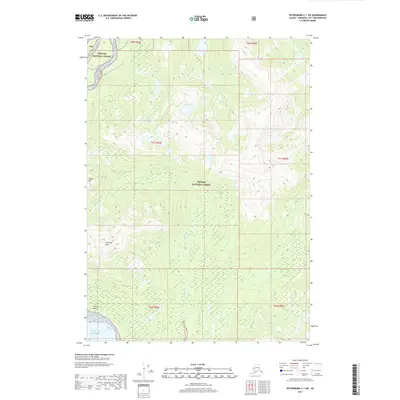
2017 Map of Petersburg C-1 SW
USGS Topo · Published 2017About this map
Tongass National Forest dominates the landscape of this 2017 survey, where the Southeast Alaskan wilderness meets the coastal waters of the Gulf of Alaska. The terrain is defined by high elevations, including the prominent Wrangell Peak and Garnet Mtn, which overlook the complex drainage systems of Crittenden Creek and Government Creek. These waterways carve through the forest, eventually reaching the saltwater of the Eastern Passage near Gerard Point. The map illustrates the topographic complexity of the coastal mountains before they drop toward the shoreline. This contemporary record captures the region's hydrological patterns, showing how the S Fork Andrew Creek and other smaller tributaries define the watershed boundaries in a territory with minimal human infrastructure.
Find a feature on this map
16 named features on this map. Tap any name to fly to it.
Don’t see what you’re looking for? This feature index may not catch every label — zoom into the map to look around manually.
Map Details
Editions of this 2017 Petersburg C-1 SW Map
This is the sole edition of this map. No revisions or reprints were ever made.
Other maps of this area

1948 · Petersburg C-1
USGS Topo · 1:63,360

1948 · Petersburg C-2
USGS Topo · 1:63,360

1948 · Petersburg B-2
USGS Topo · 1:63,360

1948 · Petersburg B-1
USGS Topo · 1:63,360

1951 · Petersburg C-2
USGS Topo · 1:63,360

1952 · Petersburg
USGS Topo · 1:250,000

1953 · Petersburg C-1
USGS Topo · 1:63,360

1953 · Petersburg B-2
USGS Topo · 1:63,360

1955 · Petersburg B-1
USGS Topo · 1:63,360

1960 · Petersburg
USGS Topo · 1:250,000