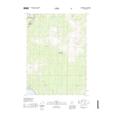
2021 Map of Petersburg C-1 SW
USGS Topo · Published 2021About this map
Wrangell Peak rises above the coastal waters of southeast Alaska in this topographical study of the Wrangell City and Borough area. The landscape is dominated by the heavily timbered slopes of the Tongass National Forest, where steep drainages like Crittenden Cr and Government Cr carve through the mountainous terrain toward the sea. Along the southwestern edge of the sheet, the land meets the Eastern Passage at Gerard Point, a distinct coastal landmark. The map illustrates the region's wilderness character, defined by massive elevation changes and a network of glacial or snow-fed streams including S Fork Andrew Cr, providing a detailed look at the island's natural geography before any significant modern road development reached this portion of the interior.
Find a feature on this map
13 named features on this map. Tap any name to fly to it.
Don’t see what you’re looking for? This feature index may not catch every label — zoom into the map to look around manually.
Map Details
Editions of this 2021 Petersburg C-1 SW Map
This is the sole edition of this map. No revisions or reprints were ever made.
Other maps of this area

1948 · Petersburg C-1
USGS Topo · 1:63,360

1948 · Petersburg C-2
USGS Topo · 1:63,360

1948 · Petersburg B-2
USGS Topo · 1:63,360

1948 · Petersburg B-1
USGS Topo · 1:63,360

1951 · Petersburg C-2
USGS Topo · 1:63,360

1952 · Petersburg
USGS Topo · 1:250,000

1953 · Petersburg C-1
USGS Topo · 1:63,360

1953 · Petersburg B-2
USGS Topo · 1:63,360

1955 · Petersburg B-1
USGS Topo · 1:63,360

1960 · Petersburg
USGS Topo · 1:250,000