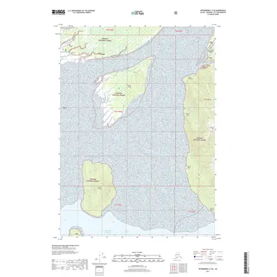
2017 Map of Petersburg C-2 SE
USGS Topo · Published 2017About this map
Wrangell and its immediate surroundings are depicted in this 2017 study of the Southeast Alaskan shoreline, where the Stikine River delta meets the Gulf of Alaska. The landscape is dominated by a complex network of waterways and silt-rich features like Binkleys Slough and the expansive Koknuk Flats, reflecting the dynamic environment of the Tongass National Forest. Significant islands such as Sergief Island and Kadin Island sit within the confluence of the Eastern Passage and larger coastal waters, while the mainland rises sharply toward the peak of Garnet Mtn. For those tracing local landmarks, the map details specific coastal points including Point Rothsay and Gerard Point, alongside the notable Garnet Ledge and the scattered Cottonwood Islands.
Find a feature on this map
22 named features on this map. Tap any name to fly to it.
Don’t see what you’re looking for? This feature index may not catch every label — zoom into the map to look around manually.
Map Details
Editions of this 2017 Petersburg C-2 SE Map
This is the sole edition of this map. No revisions or reprints were ever made.
Other maps of this area

1948 · Petersburg C-1
USGS Topo · 1:63,360

1948 · Petersburg C-2
USGS Topo · 1:63,360

1948 · Petersburg B-2
USGS Topo · 1:63,360

1948 · Petersburg B-1
USGS Topo · 1:63,360

1951 · Petersburg C-2
USGS Topo · 1:63,360

1952 · Petersburg
USGS Topo · 1:250,000

1953 · Petersburg C-1
USGS Topo · 1:63,360

1953 · Petersburg B-2
USGS Topo · 1:63,360

1955 · Petersburg B-1
USGS Topo · 1:63,360

1960 · Petersburg
USGS Topo · 1:250,000