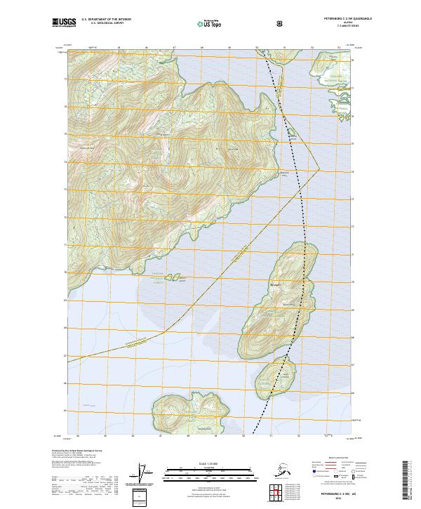
2024 Map of Petersburg C-2 SW
USGS Topo · Published 2024About this map
Mitkof Island and the surrounding Alexander Archipelago waterways dominate this modern landscape, defined by the boundaries of the Tongass National Forest and the Stikine-Leconte Wilderness. The geography is characterized by high coastal peaks including Manzanita Peak and Favor Peak, which rise above the interconnected channels of Dry Strait and Sumner Strait. Transportation is concentrated along the Mitkof Highway on the eastern shore of the island, terminating near Blaquiere Point. The map illustrates the complex island network of the region, detailing named landmasses such as Wrangell, Rynda Island, and Sokolof Island. This area serves as a primary corridor for maritime navigation and coastal access, where the borough boundary between Petersburg Borough and Wrangell Borough bisects the straits and islands, marking a modern jurisdictional divide in the southeast Alaskan wilderness.
Find a feature on this map
24 named features on this map. Tap any name to fly to it.
Don’t see what you’re looking for? This feature index may not catch every label — zoom into the map to look around manually.
Map Details
Editions of this 2024 Petersburg C-2 SW Map
This is the sole edition of this map. No revisions or reprints were ever made.
Other maps of this area

1948 · Petersburg C-2
USGS Topo · 1:63,360

1948 · Petersburg B-2
USGS Topo · 1:63,360

1948 · Petersburg C-3
USGS Topo · 1:63,360

1948 · Petersburg B-3
USGS Topo · 1:63,360

1951 · Petersburg B-3
USGS Topo · 1:63,360

1951 · Petersburg C-2
USGS Topo · 1:63,360

1952 · Petersburg
USGS Topo · 1:250,000

1953 · Petersburg B-2
USGS Topo · 1:63,360

1953 · Petersburg C-3
USGS Topo · 1:63,360

1960 · Petersburg
USGS Topo · 1:250,000