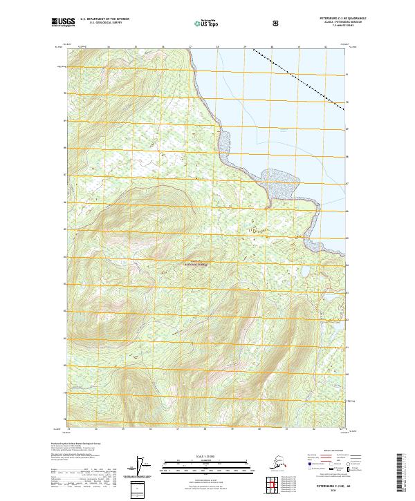
2021 Map of Petersburg C-3 NE
USGS Topo · Published 2021About this map
Tongass National Forest dominates this coastal Alaskan landscape, where the wooded slopes of the Alexander Archipelago meet the waters of Frederick Sound and Dry Strait. The area is defined by its complex network of forest access routes and trails, such as the Three Lakes Loop and the playfully named Froot Loops, which navigate the terrain between mountain drainages. Water is a constant presence, from the tidal flats near Frederick Sound to interior features like Hill Lake and the rushing waters of Canyon Creek. The topography is marked by named forest routes like Forty Dollar and Upper Bear Creek, reflecting the infrastructure of modern timber management and recreational access. Points such as Frenchy and Frederick suggest local landmarks along the steep ridges that rise from the shoreline.
Find a feature on this map
25 named features on this map. Tap any name to fly to it.
Don’t see what you’re looking for? This feature index may not catch every label — zoom into the map to look around manually.
Map Details
Editions of this 2021 Petersburg C-3 NE Map
This is the sole edition of this map. No revisions or reprints were ever made.
Other maps of this area

1948 · Petersburg C-2
USGS Topo · 1:63,360

1948 · Petersburg C-3
USGS Topo · 1:63,360

1951 · Petersburg C-2
USGS Topo · 1:63,360

1952 · Petersburg
USGS Topo · 1:250,000

1953 · Petersburg C-3
USGS Topo · 1:63,360

1960 · Petersburg
USGS Topo · 1:250,000

1961 · Petersburg D-3
USGS Topo · 1:63,360

1961 · Petersburg D-2
USGS Topo · 1:63,360
1992 · Petersburg C-3 SW
USGS Topo · 1:25,000
1992 · Petersburg D-3 SW
USGS Topo · 1:25,000