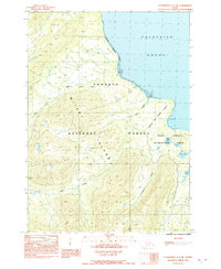
1992 Map of Petersburg C-3 NE
USGS Topo · Published 1992About this map
Mitkof Island is defined by its steep coastal topography and intricate drainage systems in this 1990s-era topographic study. The shoreline along Frederick Sound is marked by significant Tidal Flats, particularly near the Petersburg Corporate Boundary. These coastal transitions give way to the interior elevations of the Tongass National Forest, where a network of watercourses like Bear Creek and Canyon Creek carve through the landscape.
Find a feature on this map
12 named features on this map. Tap any name to fly to it.
Don’t see what you’re looking for? This feature index may not catch every label — zoom into the map to look around manually.
Map Details
Editions of this 1992 Petersburg C-3 NE Map
This is the sole edition of this map. No revisions or reprints were ever made.
Other maps of this area

1948 · Petersburg C-2
USGS Topo · 1:63,360

1948 · Petersburg C-3
USGS Topo · 1:63,360

1951 · Petersburg C-2
USGS Topo · 1:63,360

1952 · Petersburg
USGS Topo · 1:250,000

1953 · Petersburg C-3
USGS Topo · 1:63,360

1960 · Petersburg
USGS Topo · 1:250,000

1961 · Petersburg D-3
USGS Topo · 1:63,360

1961 · Petersburg D-2
USGS Topo · 1:63,360
1992 · Petersburg C-3 SW
USGS Topo · 1:25,000
1992 · Petersburg D-3 SW
USGS Topo · 1:25,000