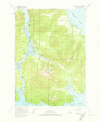
1953 Map of Petersburg C-3
USGS Topo · Published 1973About this map
Wrangell Narrows serves as the central artery for this 1953 maritime landscape, separating the Lindenberg Peninsula from Mitkof Island. The map documents a period of specialized remote activity, featuring the Alaska Experimental Fur Farm and the settlement of Papkes Landing. Along the coast, several maritime hazards and landmarks are detailed, from the California Boulder Patch to the Battery Islets, reflecting the importance of safe passage through these tidal channels.
Find a feature on this map
54 named features on this map. Tap any name to fly to it.
Don’t see what you’re looking for? This feature index may not catch every label — zoom into the map to look around manually.
Map Details
Editions of this 1953 Petersburg C-3 Map
2 editions found

Other maps of this area

1948 · Petersburg C-4
USGS Topo · 1:63,360

1948 · Petersburg C-2
USGS Topo · 1:63,360

1948 · Petersburg B-2
USGS Topo · 1:63,360

1948 · Petersburg C-3
USGS Topo · 1:63,360

1948 · Petersburg B-3
USGS Topo · 1:63,360

1949 · Petersburg B-4
USGS Topo · 1:63,360

1951 · Petersburg B-4
USGS Topo · 1:63,360

1951 · Petersburg B-3
USGS Topo · 1:63,360

1951 · Petersburg D-4
USGS Topo · 1:63,360

1951 · Petersburg C-4
USGS Topo · 1:63,360