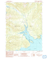
1992 Map of Petersburg C-3 SE
USGS Topo · Published 1992About this map
Mitkof Island is defined by the winding waters of Blind Slough and the Blind River as they cut through the heart of the Tongass National Forest. Compiled from early 1980s photography, this map highlights the island's coastal infrastructure and managed wilderness. The Mitkof Highway serves as the primary artery along the eastern shore, providing access to essential sites like the Crystal Lake Fish Hatchery and the Ohmer Creek Campground.
Find a feature on this map
21 named features on this map. Tap any name to fly to it.
Don’t see what you’re looking for? This feature index may not catch every label — zoom into the map to look around manually.
Map Details
Editions of this 1992 Petersburg C-3 SE Map
This is the sole edition of this map. No revisions or reprints were ever made.
Other maps of this area

1948 · Petersburg C-2
USGS Topo · 1:63,360

1948 · Petersburg B-2
USGS Topo · 1:63,360

1948 · Petersburg C-3
USGS Topo · 1:63,360

1948 · Petersburg B-3
USGS Topo · 1:63,360

1951 · Petersburg B-3
USGS Topo · 1:63,360

1951 · Petersburg C-2
USGS Topo · 1:63,360

1952 · Petersburg
USGS Topo · 1:250,000

1953 · Petersburg B-2
USGS Topo · 1:63,360

1953 · Petersburg C-3
USGS Topo · 1:63,360

1960 · Petersburg
USGS Topo · 1:250,000