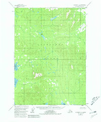
1951 Map of Petersburg C-5
USGS Topo · Published 1980About this map
Kupreanof Island dominates this mid-century topographic record, showing a landscape defined by its intricate drainage patterns and coastal inlets within the Tongass National Forest. The map detail follows the winding course of the Castle River along the eastern margin and the complex freshwater systems of the interior, including the Irish Lakes and Kushneahin Lake. While the terrain is characterized by numerous small peaks and ridges, the focus remains on the hydrography of the region, from the tidal waters of Keku Strait to the southern opening of Totem Bay. This 1951 survey, based on aerial photography from 1948, documents the area before modern development, noting that land lines represent unsurveyed locations. The absence of roads or trails during this period highlights the reliance on water routes such as Irish Creek and Tunchean Creek for navigation through this part of Southeast Alaska.
Find a feature on this map
10 named features on this map. Tap any name to fly to it.
Don’t see what you’re looking for? This feature index may not catch every label — zoom into the map to look around manually.
Map Details
Editions of this 1951 Petersburg C-5 Map
3 editions found

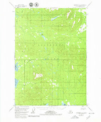
Other maps of this area

1948 · Petersburg C-4
USGS Topo · 1:63,360

1948 · Petersburg B-6
USGS Topo · 1:63,360

1948 · Petersburg D-6
USGS Topo · 1:63,360

1948 · Petersburg C-6
USGS Topo · 1:63,360

1948 · Petersburg C-5
USGS Topo · 1:63,360

1948 · Petersburg D-5
USGS Topo · 1:63,360

1949 · Petersburg B-5
USGS Topo · 1:63,360

1949 · Petersburg B-4
USGS Topo · 1:63,360

1951 · Petersburg B-4
USGS Topo · 1:63,360

1951 · Petersburg D-4
USGS Topo · 1:63,360