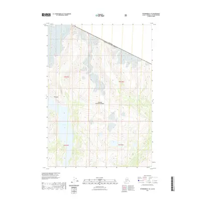
2021 Map of Petersburg D-1 SE
USGS Topo · Published 2021About this map
Shakes Glacier dominates the northern reaches of this topographic study, where ice and high-altitude terrain meet the international boundary between the United States and Canada. This landscape is characterized by the massive glacial flow feeding directly into Shakes Lake, a prominent water body situated at the foot of steep peaks including Castle Mtn. The entire region is contained within the Tongass National Forest, illustrating the remote wilderness of the Wrangell borough. The map details the complex drainage patterns and elevation contours of the boundary mountains, providing a precise record of the glacial extent and shoreline geometry at the start of the 2020s. This survey serves as a vital reference for understanding the hydrological relationship between the high ice fields and the coastal lake systems in this protected forest area.
Find a feature on this map
10 named features on this map. Tap any name to fly to it.
Don’t see what you’re looking for? This feature index may not catch every label — zoom into the map to look around manually.
Map Details
Editions of this 2021 Petersburg D-1 SE Map
This is the sole edition of this map. No revisions or reprints were ever made.
Other maps of this area

1948 · Petersburg C-1
USGS Topo · 1:63,360

1951 · Bradfield Canal
USGS Topo · 1:250,000

1952 · Petersburg
USGS Topo · 1:250,000

1953 · Petersburg C-1
USGS Topo · 1:63,360

1954 · Bradfield Canal
USGS Topo · 1:250,000

1955 · Bradfield canal D-6
USGS Topo · 1:63,360

1955 · Bradfield canal C-6
USGS Topo · 1:63,360

1955 · Bradfield Canal
USGS Topo · 1:250,000

1960 · Petersburg
USGS Topo · 1:250,000

1961 · Petersburg D-1
USGS Topo · 1:63,360