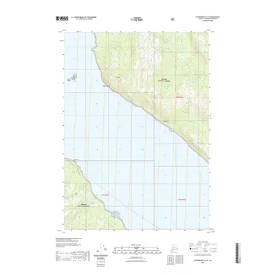
2021 Map of Petersburg D-3 SE
USGS Topo · Published 2021About this map
Tongass National Forest dominates this coastal landscape in the Petersburg Borough, where the dramatic rise of the Alexander Archipelago meets the sea. The shoreline is marked by the prominent Frederick Point, providing a navigational landmark for the waters of Frederick. Inland, the terrain reaches sharp elevations at Horn Mtn and the steep Horn Cliffs, which drop toward the coast. Water resources are evident in the managed Cabin Creek Reservoir and the drainage of Crystal Cr and Moonshine Cr. The McDonald Islands sit just offshore, highlighting the maritime character of this region. This modern survey illustrates the conservation-focused land use of Southeast Alaska, showing how infrastructure like the reservoir integrates with the surrounding forest and coastal topography.
Find a feature on this map
13 named features on this map. Tap any name to fly to it.
Don’t see what you’re looking for? This feature index may not catch every label — zoom into the map to look around manually.
Map Details
Editions of this 2021 Petersburg D-3 SE Map
This is the sole edition of this map. No revisions or reprints were ever made.
Other maps of this area

1948 · Petersburg C-2
USGS Topo · 1:63,360

1948 · Petersburg C-3
USGS Topo · 1:63,360

1951 · Petersburg C-2
USGS Topo · 1:63,360

1952 · Petersburg
USGS Topo · 1:250,000

1953 · Petersburg C-3
USGS Topo · 1:63,360

1960 · Petersburg
USGS Topo · 1:250,000

1961 · Petersburg D-3
USGS Topo · 1:63,360

1961 · Petersburg D-2
USGS Topo · 1:63,360
1992 · Petersburg D-3 SW
USGS Topo · 1:25,000
1992 · Petersburg C-3 NW
USGS Topo · 1:25,000