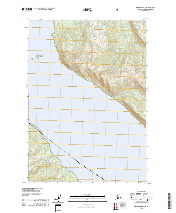
2024 Map of Petersburg D-3 SE
USGS Topo · Published 2024About this map
Petersburg sits at the southwestern edge of this coastal landscape, serving as a gateway to the steep, forested slopes of the Tongass National Forest. The topography is dominated by the dramatic ascent from the shoreline to the peaks of Horn Mtn and the precipitous Horn Cliffs, which overlook the waters of the sound. These heights are preserved within the Stikine-Leconte Wilderness, where numerous glacial-fed streams like Moonshine Creek and Crystal Creek drain toward the coast. The northern reach is defined by the sheltered Icy Cove, while Frederick Point marks a prominent navigational landmark near the town site. Inland access is focused along Frederick Road, illustrating the narrow corridor of human development between the tidewater and the high alpine ridges. The map captures the specialized geography of the Alexander Archipelago, where maritime and mountain environments meet abruptly.
Find a feature on this map
16 named features on this map. Tap any name to fly to it.
Don’t see what you’re looking for? This feature index may not catch every label — zoom into the map to look around manually.
Map Details
Editions of this 2024 Petersburg D-3 SE Map
This is the sole edition of this map. No revisions or reprints were ever made.
Other maps of this area

1948 · Petersburg C-2
USGS Topo · 1:63,360

1948 · Petersburg C-3
USGS Topo · 1:63,360

1951 · Petersburg C-2
USGS Topo · 1:63,360

1952 · Petersburg
USGS Topo · 1:250,000

1953 · Petersburg C-3
USGS Topo · 1:63,360

1960 · Petersburg
USGS Topo · 1:250,000

1961 · Petersburg D-3
USGS Topo · 1:63,360

1961 · Petersburg D-2
USGS Topo · 1:63,360
1992 · Petersburg D-3 SW
USGS Topo · 1:25,000
1992 · Petersburg C-3 NW
USGS Topo · 1:25,000