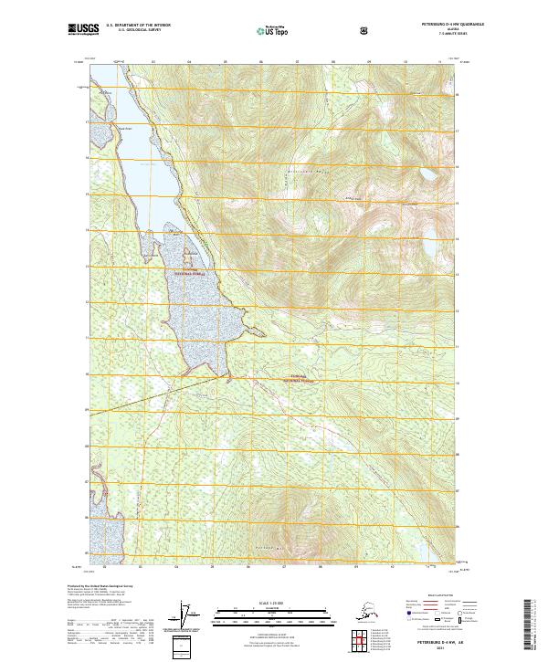
2021 Map of Petersburg D-4 NW
USGS Topo · Published 2021About this map
The Missionary Range dominates this portion of the Tongass National Forest, where steep maritime peaks rise directly from the tidal waters of Portage Bay. This 2021 survey illustrates a landscape defined by dramatic vertical relief and complex hydrology, from the high summits of Hall Peak and Chipp Peak down to the drainage basins of Goose Creek and Todahl Creek. The coastal interface is marked by distinct navigational landmarks such as Flat Point, Hook Point, and the hazardous Harrington Rock.
Find a feature on this map
26 named features on this map. Tap any name to fly to it.
Don’t see what you’re looking for? This feature index may not catch every label — zoom into the map to look around manually.
Map Details
Editions of this 2021 Petersburg D-4 NW Map
This is the sole edition of this map. No revisions or reprints were ever made.
Other maps of this area

1948 · Sumdum A-4
USGS Topo · 1:63,360

1948 · Sumdum A-5
USGS Topo · 1:63,360

1948 · Petersburg D-5
USGS Topo · 1:63,360

1951 · Petersburg D-4
USGS Topo · 1:63,360

1951 · Sumdum A-4
USGS Topo · 1:63,360

1952 · Petersburg
USGS Topo · 1:250,000

1952 · Sumdum
USGS Topo · 1:250,000

1960 · Petersburg
USGS Topo · 1:250,000

1961 · Sumdum
USGS Topo · 1:250,000
1992 · Petersburg D-4 SE
USGS Topo · 1:25,000