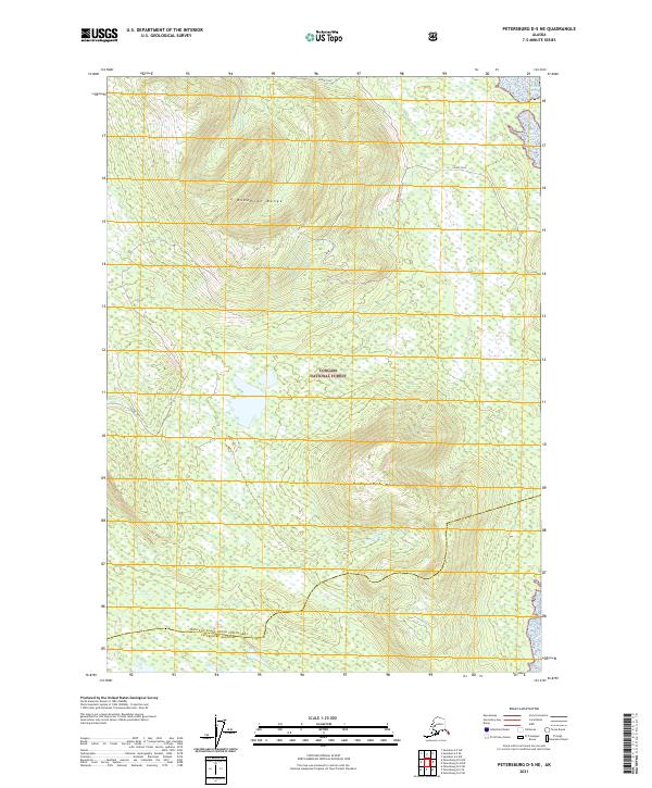
2021 Map of Petersburg D-5 NE
USGS Topo · Published 2021About this map
The Bohemian Range dominates this portion of the Tongass National Forest, illustrating the high-elevation wilderness of Southeast Alaska in the 21st century. The map centers on the steep slopes of Kupreanof Mtn and the coastal indentation of Goose Cove, showcasing a landscape defined by dramatic relief and dense drainage systems. Significant water bodies include Goose Lake, while numerous waterways like Hamilton Cr and Big Cr carve through the mountains. This 2021 survey also marks the administrative boundary between the Prince of Wales-Hyder Census Area and the Petersburg Borough, reflecting modern jurisdictional lines within this expansive forest reserve. The presence of Bohemia South indicates specific local topographical points used for modern navigation and forest management.
Find a feature on this map
15 named features on this map. Tap any name to fly to it.
Don’t see what you’re looking for? This feature index may not catch every label — zoom into the map to look around manually.
Map Details
Editions of this 2021 Petersburg D-5 NE Map
This is the sole edition of this map. No revisions or reprints were ever made.
Other maps of this area

1948 · Sumdum A-4
USGS Topo · 1:63,360

1948 · Sumdum A-5
USGS Topo · 1:63,360

1948 · Petersburg D-5
USGS Topo · 1:63,360

1951 · Petersburg D-4
USGS Topo · 1:63,360

1951 · Sumdum A-4
USGS Topo · 1:63,360

1952 · Petersburg
USGS Topo · 1:250,000

1952 · Sumdum
USGS Topo · 1:250,000

1960 · Petersburg
USGS Topo · 1:250,000

1961 · Sumdum
USGS Topo · 1:250,000
1995 · Petersburg D-4
USGS Topo · 1:63,360