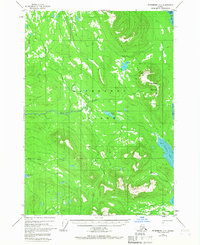
1948 Map of Petersburg D-5
USGS Topo · Published 1967About this map
Kupreanof Island defines this portion of the Alexander Archipelago, showing a landscape of glacial carving and complex maritime inlets as they were documented in the late 1940s. The topographic detail follows the steep rise from the Towers Arm shoreline to the prominent peaks of Kupreanof Mountain and the Bohemian Range. This map reflects an era of aerial survey where much of the interior remained unsurveyed and unmarked by formal land lines, emphasizing the wilderness character of the Tongass National Forest. Inland water systems like Towers Lake and the winding Hamilton Creek suggest the difficult travel routes through the dense forest and muskeg of the island’s interior. Along the coast, features such as Portage Bay and the tidal flats of Big John Bay highlight the importance of water access for any human activity in this corner of Southeast Alaska.
Find a feature on this map
18 named features on this map. Tap any name to fly to it.
Don’t see what you’re looking for? This feature index may not catch every label — zoom into the map to look around manually.
Map Details
Editions of this 1948 Petersburg D-5 Map
3 editions found
Other maps of this area

1948 · Sumdum A-4
USGS Topo · 1:63,360

1948 · Sumdum A-5
USGS Topo · 1:63,360

1948 · Petersburg C-4
USGS Topo · 1:63,360

1948 · Sumdum A-6
USGS Topo · 1:63,360

1948 · Petersburg D-6
USGS Topo · 1:63,360

1948 · Petersburg C-6
USGS Topo · 1:63,360

1948 · Petersburg C-5
USGS Topo · 1:63,360

1948 · Petersburg D-5
USGS Topo · 1:63,360

1951 · Petersburg D-4
USGS Topo · 1:63,360

1951 · Petersburg D-6
USGS Topo · 1:63,360