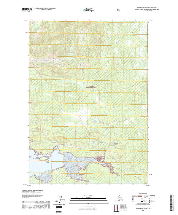
2021 Map of Petersburg D-6 NE
USGS Topo · Published 2021About this map
Kupreanof Island landscape within the Tongass National Forest is defined by its complex network of tidal waterways and interior muskeg. This modern survey illustrates the essential transit corridors that connect the coastal points, such as Kake Road and the Hamilton Creek Trl. The coastline is dotted with geographic markers including Little Hamilton Island and Seal Point, where the land meets the Reku Strait.
Find a feature on this map
25 named features on this map. Tap any name to fly to it.
Don’t see what you’re looking for? This feature index may not catch every label — zoom into the map to look around manually.
Map Details
Editions of this 2021 Petersburg D-6 NE Map
This is the sole edition of this map. No revisions or reprints were ever made.
Other maps of this area

1948 · Sumdum A-5
USGS Topo · 1:63,360

1948 · Sumdum A-6
USGS Topo · 1:63,360

1948 · Petersburg D-6
USGS Topo · 1:63,360

1948 · Petersburg D-5
USGS Topo · 1:63,360

1951 · Petersburg D-6
USGS Topo · 1:63,360

1952 · Petersburg
USGS Topo · 1:250,000

1952 · Sumdum
USGS Topo · 1:250,000

1960 · Petersburg
USGS Topo · 1:250,000

1961 · Sumdum
USGS Topo · 1:250,000
1994 · Sumdum A-6
USGS Topo · 1:63,360