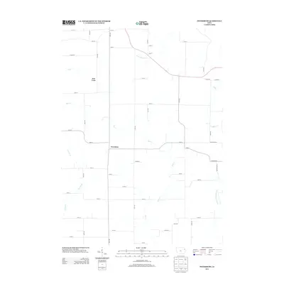
2013 Map of Petersburg
USGS Topo · Published 2013About this map
Petersburg and Holy Cross anchor this Delaware County landscape, characterized by the intricate drainage systems of northeastern Iowa. The north-central section is defined by the Little Turkey River, which flows through a region dissected by numerous tributaries including Elk Cr and Bear Cr. To the southeast, the headwaters of the N Fork Maquoketa River begin to emerge, shaping the local topography. This map illustrates the intersection of these waterways with a rigid section-line road grid, where long avenues such as 290th Ave and 300th Ave facilitate travel between scattered farmsteads. The placement of these settlements relative to Coffee Cr and Garretts Br reflects the historical reliance on local water sources for early agricultural development in this corner of the state.
Find a feature on this map
46 named features on this map. Tap any name to fly to it.
Don’t see what you’re looking for? This feature index may not catch every label — zoom into the map to look around manually.
Map Details
Editions of this 2013 Petersburg Map
This is the sole edition of this map. No revisions or reprints were ever made.
Other maps of this area

1900 · Anamosa
USGS Topo · 1:125,000

1902 · Elkader
USGS Topo · 1:125,000

1957 · Turkey River
USGS Topo · 1:24,000

1957 · Colesburg
USGS Topo · 1:24,000

1959 · Dubuque
USGS Topo · 1:250,000

1961 · Dubuque
USGS Topo · 1:250,000

1962 · Dubuque
USGS Topo · 1:250,000
1962 · New Vienna
USGS Topo · 1:24,000

1962 · Petersburg
USGS Topo · 1:24,000

1964 · Garber
USGS Topo · 1:24,000