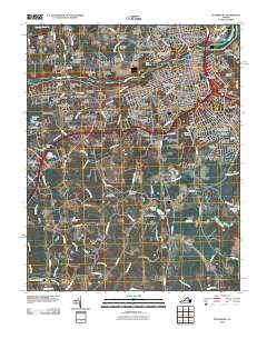
2010 Map of Petersburg
USGS Topo · Published 2010About this map
Petersburg and Colonial Heights are separated by the winding Appomattox River, where industrial and civil history converge. The map documents a landscape deeply shaped by its military past, centered on Battlefield Park and the site of The Crater. Local heritage is anchored by significant funerary sites, including the expansive Blandford Cemetery and Poplar Grove National Cemetery. These areas are balanced by mid-century residential growth in neighborhoods like Walnut Hill and Ettrick, which borders the Virginia State University campus. South of the city center, the terrain transitions into a network of wetlands and creek systems, notably Second Swamp and Blackwater Swamp, which define the natural boundaries of the region's expansion. The proximity of Collier Yard and multiple post offices across Battersea and Woodmere highlights the area's role as a logistical and residential hub.
Find a feature on this map
134 named features on this map. Tap any name to fly to it.
Don’t see what you’re looking for? This feature index may not catch every label — zoom into the map to look around manually.
Map Details
Editions of this 2010 Petersburg Map
This is the sole edition of this map. No revisions or reprints were ever made.
Other maps of this area

1894 · Bermuda Hundred
USGS Topo · 1:62,500

1894 · Petersburg
USGS Topo · 1:62,500

1897 · Amelia
USGS Topo · 1:125,000

1943 · Hopewell
USGS Topo · 1:31,680

1943 · Dinwiddie
USGS Topo · 1:24,000

1943 · Beach
USGS Topo · 1:24,000

1943 · Sutherland
USGS Topo · 1:24,000

1943 · Richmond
USGS Topo · 1:250,000
1944 · Beach
USGS Topo · 1:31,680

1944 · Reams
USGS Topo · 1:31,680