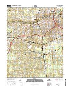
2016 Map of Petersburg
USGS Topo · Published 2016About this map
The Appomattox River carves through this landscape, separating Colonial Heights and Ettrick from the urban center of Petersburg. This 2016 survey documents the extensive preservation of civil war sites within the Petersburg National Battlefield, which spans both the northern and southern portions of the map. The area is notable for its high concentration of historic burial grounds, including the large Blandford Cem and smaller sites like Rod of Sholom Cem and Saint Josephs Cem.
Find a feature on this map
52 named features on this map. Tap any name to fly to it.
Don’t see what you’re looking for? This feature index may not catch every label — zoom into the map to look around manually.
Map Details
Editions of this 2016 Petersburg Map
This is the sole edition of this map. No revisions or reprints were ever made.
Other maps of this area

1894 · Bermuda Hundred
USGS Topo · 1:62,500

1894 · Petersburg
USGS Topo · 1:62,500

1897 · Amelia
USGS Topo · 1:125,000

1943 · Hopewell
USGS Topo · 1:31,680

1943 · Dinwiddie
USGS Topo · 1:24,000

1943 · Beach
USGS Topo · 1:24,000

1943 · Sutherland
USGS Topo · 1:24,000

1943 · Richmond
USGS Topo · 1:250,000
1944 · Beach
USGS Topo · 1:31,680

1944 · Reams
USGS Topo · 1:31,680