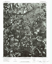
1974 Map of Petersburg
USGS Topo · Published 1977About this map
Petersburg and Colonial Heights dominate the upper half of this 1974 orthophotoquad, showing the dense urban and suburban development flanking the Appomattox River. Unlike a traditional topographic map, this aerial perspective provides a clear view of land use patterns, from the organized grid of the city centers to the winding residential streets and expanding industrial footprints of the mid-1970s. South of the city, the landscape transitions into a patchwork of woodlots and agricultural clearings, revealing the extent of rural Dinwiddie County before later decades of further expansion. The imagery is particularly useful for identifying the specific road alignments and highway interchanges that shaped the region's mid-century growth.
Find a feature on this map
3 named features on this map. Tap any name to fly to it.
Don’t see what you’re looking for? This feature index may not catch every label — zoom into the map to look around manually.
Map Details
Editions of this 1974 Petersburg Map
This is the sole edition of this map. No revisions or reprints were ever made.
Other maps of this area

1894 · Bermuda Hundred
USGS Topo · 1:62,500

1894 · Petersburg
USGS Topo · 1:62,500

1897 · Amelia
USGS Topo · 1:125,000

1943 · Hopewell
USGS Topo · 1:31,680

1943 · Dinwiddie
USGS Topo · 1:24,000

1943 · Beach
USGS Topo · 1:24,000

1943 · Sutherland
USGS Topo · 1:24,000

1943 · Richmond
USGS Topo · 1:250,000
1944 · Beach
USGS Topo · 1:31,680

1944 · Reams
USGS Topo · 1:31,680