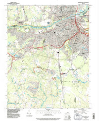
1994 Map of Petersburg
USGS Topo · Published 1996About this map
The Appomattox River carves through the heart of this landscape, separating the established city of Petersburg from Colonial Heights and the industrial and educational centers to the north. This mid-1990s revision reveals a complex layering of military history and modern infrastructure, where the sprawling grounds of the Petersburg Nat Battlefield and defensive sites like Fort Gregg and Fort Davis are intersected by major transportation corridors and the Seaboard System railroad.
Find a feature on this map
59 named features on this map. Tap any name to fly to it.
Don’t see what you’re looking for? This feature index may not catch every label — zoom into the map to look around manually.
Map Details
Editions of this 1994 Petersburg Map
This is the sole edition of this map. No revisions or reprints were ever made.
Other maps of this area

1894 · Bermuda Hundred
USGS Topo · 1:62,500

1894 · Petersburg
USGS Topo · 1:62,500

1897 · Amelia
USGS Topo · 1:125,000

1943 · Hopewell
USGS Topo · 1:31,680

1943 · Dinwiddie
USGS Topo · 1:24,000

1943 · Beach
USGS Topo · 1:24,000

1943 · Sutherland
USGS Topo · 1:24,000

1943 · Richmond
USGS Topo · 1:250,000
1944 · Beach
USGS Topo · 1:31,680

1944 · Reams
USGS Topo · 1:31,680