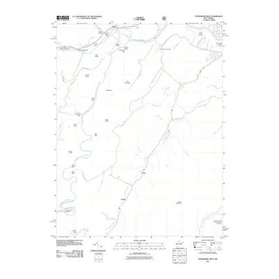
2011 Map of Petersburg West
USGS Topo · Published 2011About this map
The South Branch Potomac River and its tributary, the North Fork South Branch Potomac River, dictate the rugged geography of this region in Grant County. Small settlements and local landmarks are concentrated along the river valleys and the winding path of County Hwy 220/2, which connects the communities of Cabins and Pansy. The northern portion of the map highlights local infrastructure including the Cabins Post Office and the Petersburg Fish Hatchery, while the Grant County Airport sits on the plateau above the river bend.
Find a feature on this map
42 named features on this map. Tap any name to fly to it.
Don’t see what you’re looking for? This feature index may not catch every label — zoom into the map to look around manually.
Map Details
Editions of this 2011 Petersburg West Map
This is the sole edition of this map. No revisions or reprints were ever made.
Other maps of this area

1892 · Franklin
USGS Topo · 1:125,000

1895 · Piedmont
USGS Topo · 1:125,000

1896 · Franklin
USGS Topo · 1:125,000

1916 · Davis
USGS Topo · 1:48,000

1918 · Davis
USGS Topo · 1:62,500

1919 · Davis
USGS Topo · 1:62,500

1920 · Davis
USGS Topo · 1:48,000

1920 · Petersburg
USGS Topo · 1:48,000

1920 · Onego
USGS Topo · 1:62,500

1921 · Petersburg
USGS Topo · 1:48,000