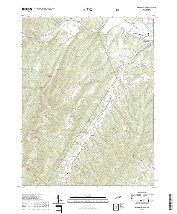
2023 Map of Petersburg West
USGS Topo · Published 2023About this map
The North-Fork South Branch Potomac River carves through the Appalachian landscape, defining the topography of this region near the border of Grant and Pendleton counties. The terrain is characterized by a series of prominent gaps and ridges, including Stillhouse Gap, Bean Gap, and the massive bulk of Cave Mtn. Within the protected boundaries of the Monongahela National Forest, features like Smoke Hole and Castle Rock highlight the geologic complexity of the valley. Settlement patterns follow the water and road corridors, with small communities like Landes, Pansy, and Cabins situated along the lower elevations. Local history is anchored by the Bethel Church and small family burial sites such as the Bible Family Cem and Alt Cem, which remain as markers of the area's rural heritage. The inclusion of the Grant County Airport and the State Trout Hatchery-Spring reflects the modern infrastructure supporting the community alongside its traditional agricultural and forested lands.
Find a feature on this map
62 named features on this map. Tap any name to fly to it.
Don’t see what you’re looking for? This feature index may not catch every label — zoom into the map to look around manually.
Map Details
Editions of this 2023 Petersburg West Map
This is the sole edition of this map. No revisions or reprints were ever made.
Other maps of this area

1892 · Franklin
USGS Topo · 1:125,000

1895 · Piedmont
USGS Topo · 1:125,000

1896 · Franklin
USGS Topo · 1:125,000

1916 · Davis
USGS Topo · 1:48,000

1918 · Davis
USGS Topo · 1:62,500

1919 · Davis
USGS Topo · 1:62,500

1920 · Davis
USGS Topo · 1:48,000

1920 · Petersburg
USGS Topo · 1:48,000

1920 · Onego
USGS Topo · 1:62,500

1921 · Petersburg
USGS Topo · 1:48,000