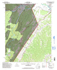
1995 Map of Petersburg West
USGS Topo · Published 1998About this map
The South Branch Potomac River carves through the landscape of Grant and Pendleton Counties, defining the agricultural and recreational character of this mid-1990s terrain. The area is dominated by the massive presence of the Monongahela National Forest Spruce Knob - Seneca Rocks National Recreation Area, where prominent geological features like Castle Rock, Bulls Head, and Dayton Knob tower over the river valley. Local community life is centered around several country churches, including Marvin Chapel, Bethel Ch, and Gordon Chapel. The transportation and economic infrastructure are highlighted by the Petersburg Airport and the Petersburg Fish Hatchery located near the river's bend. Along the slopes of Big Mountain, numerous hollows like Landes Hollow and Gum Hollow drain into the primary river system, reflecting a landscape shaped by water and elevation.
Find a feature on this map
42 named features on this map. Tap any name to fly to it.
Don’t see what you’re looking for? This feature index may not catch every label — zoom into the map to look around manually.
Map Details
Editions of this 1995 Petersburg West Map
This is the sole edition of this map. No revisions or reprints were ever made.
Other maps of this area

1892 · Franklin
USGS Topo · 1:125,000

1895 · Piedmont
USGS Topo · 1:125,000

1896 · Franklin
USGS Topo · 1:125,000

1916 · Davis
USGS Topo · 1:48,000

1918 · Davis
USGS Topo · 1:62,500

1919 · Davis
USGS Topo · 1:62,500

1920 · Davis
USGS Topo · 1:48,000

1920 · Petersburg
USGS Topo · 1:48,000

1920 · Onego
USGS Topo · 1:62,500

1921 · Petersburg
USGS Topo · 1:48,000