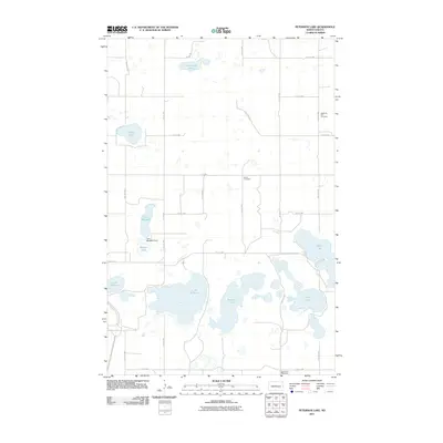
2011 Map of Peterson Lake
USGS Topo · Published 2011About this map
Peterson Lake and the surrounding prairie pothole landscape of McLean County dominate this 2011 survey. The terrain is defined by an intricate network of glacial lakes and wetlands, ranging from the large expanse of Lake Williams to smaller bodies like Cottonwood Lake and Nelson Lake. This environment highlights the importance of water management in the region, evidenced by the Lake Margaret Dam situated between Lake Margaret and Billows Lake.
Find a feature on this map
20 named features on this map. Tap any name to fly to it.
Don’t see what you’re looking for? This feature index may not catch every label — zoom into the map to look around manually.
Map Details
Editions of this 2011 Peterson Lake Map
This is the sole edition of this map. No revisions or reprints were ever made.
Other maps of this area

1945 · Pelican Lake
USGS Topo · 1:62,500

1947 · Pelican Lake
USGS Topo · 1:62,500

1947 · Turtle Lake
USGS Topo · 1:62,500

1949 · Turtle Creek
USGS Topo · 1:62,500

1954 · McClusky
USGS Topo · 1:250,000

1958 · McClusky
USGS Topo · 1:250,000

1959 · Mercer
USGS Topo · 1:24,000

1961 · Turtle Lake
USGS Topo · 1:24,000

1961 · Turtle Creek NE
USGS Topo · 1:24,000
1961 · Peterson Lake
USGS Topo · 1:24,000