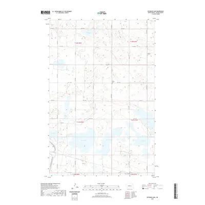
2020 Map of Peterson Lake
USGS Topo · Published 2020About this map
Lake Williams and Peterson Lake dominate the central basin of this McLean County landscape, where the prairie is defined by a dense network of glacial potholes and larger water bodies. The geography is marked by small, scattered cemeteries that reflect the early rural settlement patterns of the region, including Medicine Hill Cem near the prominent elevation of Medicine Hill and Peace Lutheran Cem farther south. In the southwestern corner, the N Country National Scenic Trail winds through the wetlands and rolling terrain, passing west of Lake Holmes. The map also details a strictly organized grid of rural section roads such as Co RD 27 and Co RD 10, connecting isolated farmsteads and agricultural plots across several townships. This modern survey shows a region where the natural hydrography of lakes like Blue Lake and Pelican Lake remains the primary influence on land use and transit.
Find a feature on this map
29 named features on this map. Tap any name to fly to it.
Don’t see what you’re looking for? This feature index may not catch every label — zoom into the map to look around manually.
Map Details
Editions of this 2020 Peterson Lake Map
This is the sole edition of this map. No revisions or reprints were ever made.
Other maps of this area

1945 · Pelican Lake
USGS Topo · 1:62,500

1947 · Pelican Lake
USGS Topo · 1:62,500

1947 · Turtle Lake
USGS Topo · 1:62,500

1949 · Turtle Creek
USGS Topo · 1:62,500

1954 · McClusky
USGS Topo · 1:250,000

1958 · McClusky
USGS Topo · 1:250,000

1959 · Mercer
USGS Topo · 1:24,000

1961 · Turtle Lake
USGS Topo · 1:24,000

1961 · Turtle Creek NE
USGS Topo · 1:24,000
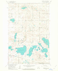
1961 · Peterson Lake
USGS Topo · 1:24,000