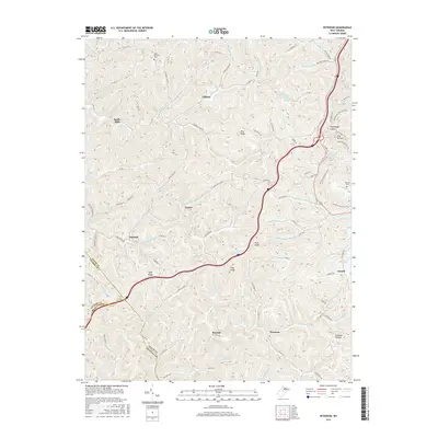
2016 Map of Peterson
USGS Topo · Published 2016About this map
Bealls Mills and the high ridges of Lewis County define this landscape, where the headwaters of numerous forks and runs carve deep into the Allegheny Plateau. The topography is marked by significant elevations like Pine Knob and Rush Knob, with the local road network often following the narrow hollows such as Rohrbough Hollow and Camden Hollow. Small settlements and naming conventions suggest a history tied to specific families and local industry, including Bennett, Finster, and Gillooly.
Find a feature on this map
100 named features on this map. Tap any name to fly to it.
Don’t see what you’re looking for? This feature index may not catch every label — zoom into the map to look around manually.
Map Details
Editions of this 2016 Peterson Map
This is the sole edition of this map. No revisions or reprints were ever made.
Other maps of this area

1893 · Buckhannon
USGS Topo · 1:125,000

1893 · Sutton
USGS Topo · 1:125,000

1896 · Buckhannon
USGS Topo · 1:125,000

1897 · Buckhannon
USGS Topo · 1:125,000

1904 · Weston
USGS Topo · 1:62,500

1904 · Vadis
USGS Topo · 1:62,500

1906 · Burnsville
USGS Topo · 1:62,500

1912 · Crawford
USGS Topo · 1:48,000

1914 · Crawford
USGS Topo · 1:62,500

1925 · Burnsville
USGS Topo · 1:62,500