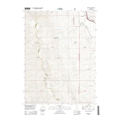
2014 Map of Peterson
USGS Topo · Published 2014About this map
Peterson and Enterprise anchor the northeastern corner of this landscape, situated where the Wasatch National Forest meets the developed valley floor. The geography is defined by the high crests of the Wasatch Range, featuring prominent summits like Thurston Peak and Francis Peak. This 2014 survey documents the modern infrastructure of the region, including the Francis Radar Station and the Francis Peak Overlook, which provide vantage points over the complex network of drainage basins. The area is dissected by numerous waterways such as Right Hand Fork Peterson Cr and Smith Cr, which flow from the high country toward the settled areas. Local history is marked by the Peterson Cem, located just off Peterson Rd, while the terrain transitions into distinctive formations like The Hogsback and the Dry Hollow drainage to the east.
Find a feature on this map
57 named features on this map. Tap any name to fly to it.
Don’t see what you’re looking for? This feature index may not catch every label — zoom into the map to look around manually.
Map Details
Editions of this 2014 Peterson Map
This is the sole edition of this map. No revisions or reprints were ever made.
Other maps of this area

1885 · Salt Lake
USGS Topo · 1:250,000

1925 · Ft. Douglas
USGS Topo · 1:125,000

1928 · Ft. Douglas
USGS Topo · 1:125,000

1952 · Farmington
USGS Topo · 1:24,000

1952 · Bountiful Peak
USGS Topo · 1:24,000

1954 · Salt Lake City
USGS Topo · 1:250,000

1954 · Ogden
USGS Topo · 1:250,000

1955 · Ogden
USGS Topo · 1:24,000

1955 · Peterson
USGS Topo · 1:24,000

1955 · Kaysville
USGS Topo · 1:24,000