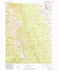
1991 Map of Peterson
USGS Topo · Published 1992About this map
The Weber River winds through the Morgan Valley at the northeastern edge of this 1991 survey, where the small community of Peterson serves as a primary point of reference. The settlement's local history is anchored by the Peterson Cem and the surrounding irrigation network of canals and pipelines. To the west, the landscape rises dramatically into the Wasatch National Forest, dominated by the high ridgeline separating Davis and Morgan counties.
Find a feature on this map
42 named features on this map. Tap any name to fly to it.
Don’t see what you’re looking for? This feature index may not catch every label — zoom into the map to look around manually.
Map Details
Editions of this 1991 Peterson Map
This is the sole edition of this map. No revisions or reprints were ever made.
Other maps of this area

1885 · Salt Lake
USGS Topo · 1:250,000

1925 · Ft. Douglas
USGS Topo · 1:125,000

1928 · Ft. Douglas
USGS Topo · 1:125,000

1952 · Farmington
USGS Topo · 1:24,000

1952 · Bountiful Peak
USGS Topo · 1:24,000

1954 · Salt Lake City
USGS Topo · 1:250,000

1954 · Ogden
USGS Topo · 1:250,000

1955 · Ogden
USGS Topo · 1:24,000

1955 · Peterson
USGS Topo · 1:24,000

1955 · Kaysville
USGS Topo · 1:24,000