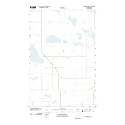
2011 Map of Petrified Lake
USGS Topo · Published 2011About this map
Petrified Lake and its surrounding prairie pothole wetlands define this section of Pierce County, North Dakota. The landscape is characterized by a high concentration of shallow water bodies, including Girard Lake, Round Lake, and the slender profile of Long Lake to the east. This 2011 survey reveals a strictly organized section-line road network that segments the terrain into a precise grid of agricultural and conservation lands. The geometry of routes like 46th St NE and 31st Ave NE demonstrates the enduring influence of the Public Land Survey System on the Northern Plains. While the area lacks dense settlements, the map provides an essential look at the hydrography and topography of the region before modern climatic shifts might alter these sensitive wetland boundaries.
Find a feature on this map
17 named features on this map. Tap any name to fly to it.
Don’t see what you’re looking for? This feature index may not catch every label — zoom into the map to look around manually.
Map Details
Editions of this 2011 Petrified Lake Map
This is the sole edition of this map. No revisions or reprints were ever made.
Other maps of this area

1940 · Aylmer
USGS Topo · 1:62,500

1941 · Selz
USGS Topo · 1:62,500

1951 · Selz NE
USGS Topo · 1:24,000

1951 · Selz NW
USGS Topo · 1:24,000

1952 · New Rockford
USGS Topo · 1:250,000

1953 · Devils Lake
USGS Topo · 1:250,000

1954 · Minot
USGS Topo · 1:250,000

1954 · McClusky
USGS Topo · 1:250,000

1956 · New Rockford
USGS Topo · 1:250,000

1956 · Devils Lake
USGS Topo · 1:250,000