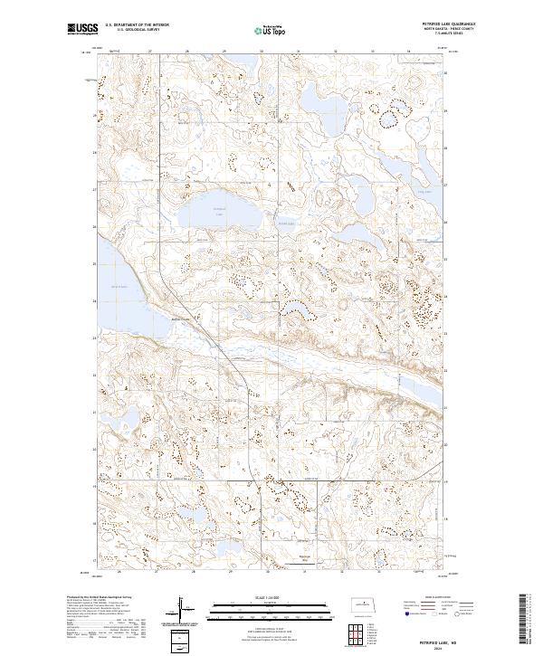
2024 Map of Petrified Lake
USGS Topo · Published 2024About this map
Petrified Lake serves as a focal point in this portion of Pierce County, where the landscape is defined by the prairie pothole region's characteristic wetland density. This modern survey shows a mosaic of conservation lands and glacial hydrology, including the northern reaches of the Buffalo Lake National Wildlife Refuge and multiple units of the Pierce County Waterfowl Production Area. The terrain is marked by a network of sectional roads such as 30th Ave NE and 47th St NE, which carve the plains into a precise grid of agricultural and protected lands. Beyond the larger water bodies like Girard Lake and Long Lake, the area's history is hinted at by the Ripplinger Strip, while the Buffalo Coulee indicates the subtle drainage patterns that cross this glaciated North Dakota prairie.
Find a feature on this map
28 named features on this map. Tap any name to fly to it.
Don’t see what you’re looking for? This feature index may not catch every label — zoom into the map to look around manually.
Map Details
Editions of this 2024 Petrified Lake Map
This is the sole edition of this map. No revisions or reprints were ever made.
Other maps of this area

1940 · Aylmer
USGS Topo · 1:62,500

1941 · Selz
USGS Topo · 1:62,500

1951 · Selz NE
USGS Topo · 1:24,000

1951 · Selz NW
USGS Topo · 1:24,000

1952 · New Rockford
USGS Topo · 1:250,000

1953 · Devils Lake
USGS Topo · 1:250,000

1954 · Minot
USGS Topo · 1:250,000

1954 · McClusky
USGS Topo · 1:250,000

1956 · New Rockford
USGS Topo · 1:250,000

1956 · Devils Lake
USGS Topo · 1:250,000