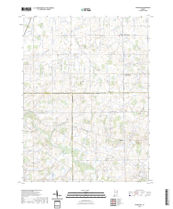
2022 Map of Petroleum
USGS Topo · Published 2022About this map
The Salamonie River meanders through the southern half of this landscape, carving a low-lying valley defined by small tributaries like Beaver Cr and Haines Cr. Settled areas like Petroleum and Nottingham follow the established grid of county roads, while the crossroads of Fiat and Balbec anchor the southern reach near the Blackford and Jay County line. This region is heavily defined by an intricate network of drainage ditches, including the Bloxsom Ditch and Sharpe Ditch, which were essential for converting the naturally wet terrain into productive farmland. Genealogy researchers may find interest in the centrally located Bloxsom Cem, situated between the upper reaches of Rock Cr and the Scuffle Cr. The map captures a moment of modern agricultural infrastructure layered over a historical township system.
Find a feature on this map
88 named features on this map. Tap any name to fly to it.
Don’t see what you’re looking for? This feature index may not catch every label — zoom into the map to look around manually.
Map Details
Editions of this 2022 Petroleum Map
This is the sole edition of this map. No revisions or reprints were ever made.
Other maps of this area

1953 · Muncie
USGS Topo · 1:250,000

1956 · Muncie
USGS Topo · 1:250,000

1960 · Pennville
USGS Topo · 1:24,000

1960 · Hartford City East
USGS Topo · 1:24,000

1960 · Blaine
USGS Topo · 1:24,000

1962 · Montpelier
USGS Topo · 1:24,000

1962 · Liberty Center
USGS Topo · 1:24,000

1962 · Petroleum
USGS Topo · 1:24,000

1962 · Linn Grove
USGS Topo · 1:24,000
1962 · Domestic
USGS Topo · 1:24,000