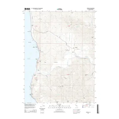
2015 Map of Petrolia
USGS Topo · Published 2015About this map
Petrolia serves as the focal point of this coastal survey, where the Mattole River and its North Fork wind through a landscape defined by sharp ridges and deep gulches. The settlement is anchored by local landmarks like the Petrolia Cemetery and connected by historic routes such as Mattole Rd and Old Mattole Rd. Along the shoreline, the survey documents a series of rocky outcrops including Mussel Rock, The Brothers, and Punta Gorda. The transition from the alluvial valley floor to the elevations of Prosper Ridge and Cooksie Mountain illustrates the area's complex drainage patterns, with numerous named watercourses like Bear Creek and Fourmile Creek feeding into the main river system before it reaches Mattole Beach.
Find a feature on this map
61 named features on this map. Tap any name to fly to it.
Don’t see what you’re looking for? This feature index may not catch every label — zoom into the map to look around manually.
Map Details
Editions of this 2015 Petrolia Map
This is the sole edition of this map. No revisions or reprints were ever made.
Other maps of this area

1919 · Glynn
USGS Topo · 1:62,500

1920 · Pt. Delagda
USGS Topo · 1:62,500

1921 · Cape Mendocino
USGS Topo · 1:62,500

1926 · Gorda
USGS Topo · 1:62,500

1949 · Eureka
USGS Topo · 1:250,000

1949 · Point Delgada
USGS Topo · 1:62,500

1950 · Cape Mendocino
USGS Topo · 1:62,500

1950 · Scotia
USGS Topo · 1:62,500

1951 · Scotia
USGS Topo · 1:62,500

1951 · Point Delgada
USGS Topo · 1:62,500