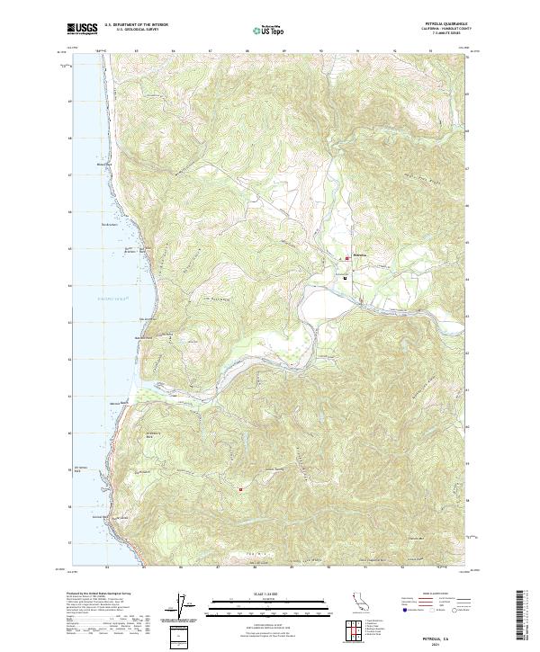
2021 Map of Petrolia
USGS Topo · Published 2021About this map
Petrolia serves as the inland anchor of this coastal landscape, situated where the N Fork Mattole River meets the main stem of the Mattole River. The 2021 survey details a region defined by dramatic seaside landmarks and ridge systems, from the prominent Punta Gorda at the southern edge of Mattole Beach up to the distinctive Mussel Rock in the north. The area's complex geography is reflected in colorful local nomenclature, including Uncle Tommy, Shenanigan Ridge, and Johnny Jack Ridge. Researchers can trace the legacy of early ranching and coastal passage through family-named features like Moore Hill and Collins Gulch, alongside the winding Lost Coast Trl. Settlement patterns are concentrated along the river valley via Mattole Rd, while the higher elevations of Cooskie Mtn and Little Chaparral Mtn remain largely defined by natural contours and gulches like Jim Goff Gulch.
Find a feature on this map
64 named features on this map. Tap any name to fly to it.
Don’t see what you’re looking for? This feature index may not catch every label — zoom into the map to look around manually.
Map Details
Editions of this 2021 Petrolia Map
This is the sole edition of this map. No revisions or reprints were ever made.
Other maps of this area

1919 · Glynn
USGS Topo · 1:62,500

1920 · Pt. Delagda
USGS Topo · 1:62,500

1921 · Cape Mendocino
USGS Topo · 1:62,500

1926 · Gorda
USGS Topo · 1:62,500

1949 · Eureka
USGS Topo · 1:250,000

1949 · Point Delgada
USGS Topo · 1:62,500

1950 · Cape Mendocino
USGS Topo · 1:62,500

1950 · Scotia
USGS Topo · 1:62,500

1951 · Scotia
USGS Topo · 1:62,500

1951 · Point Delgada
USGS Topo · 1:62,500