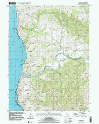
1997 Map of Petrolia
USGS Topo · Published 2002About this map
Petrolia and the surrounding coastline reflect a landscape shaped by early California resource extraction and the winding course of the Mattole River. The map highlights a significant historical landmark, the State Historical Mon 543 First Oil Field in California, marking the site of the state's first oil well. Settlement is concentrated along the river valley and the Mattole Road, while the rugged coastal interior is defined by massive landforms like Prosper Ridge and Shenanigan Ridge.
Find a feature on this map
43 named features on this map. Tap any name to fly to it.
Don’t see what you’re looking for? This feature index may not catch every label — zoom into the map to look around manually.
Map Details
Editions of this 1997 Petrolia Map
This is the sole edition of this map. No revisions or reprints were ever made.
Other maps of this area

1919 · Glynn
USGS Topo · 1:62,500

1920 · Pt. Delagda
USGS Topo · 1:62,500

1921 · Cape Mendocino
USGS Topo · 1:62,500

1926 · Gorda
USGS Topo · 1:62,500

1949 · Eureka
USGS Topo · 1:250,000

1949 · Point Delgada
USGS Topo · 1:62,500

1950 · Cape Mendocino
USGS Topo · 1:62,500

1950 · Scotia
USGS Topo · 1:62,500

1951 · Scotia
USGS Topo · 1:62,500

1951 · Point Delgada
USGS Topo · 1:62,500