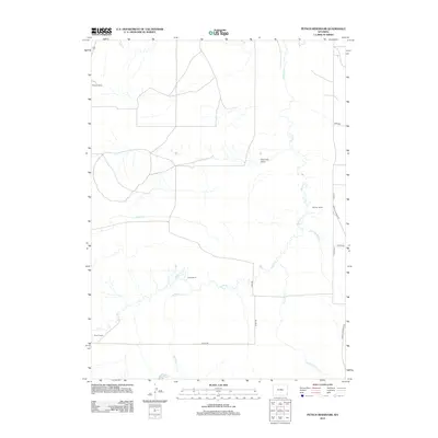
2012 Map of Petsch Reservoir
USGS Topo · Published 2012About this map
Horse Cr and its winding tributaries dominate this corner of Laramie County, shaping a landscape defined by ranching and water management. Named family holdings like Gregory Ranch, Johnson Ranch, and Davis Ranch are scattered across the terrain, reflecting the long-standing agricultural tradition in this part of Wyoming. The map records several essential water features including the Coad Ditch and Petsch Reservoir, which facilitate irrigation in a region where seasonal flows from Stinking Water Cr and Kellehan Cr are critical to local operations.
Find a feature on this map
19 named features on this map. Tap any name to fly to it.
Don’t see what you’re looking for? This feature index may not catch every label — zoom into the map to look around manually.
Map Details
Editions of this 2012 Petsch Reservoir Map
This is the sole edition of this map. No revisions or reprints were ever made.
Other maps of this area

1899 · Goshen Hole
USGS Topo · 1:125,000

1954 · Cheyenne
USGS Topo · 1:250,000

1958 · Cheyenne
USGS Topo · 1:250,000

1960 · Tremain
USGS Topo · 1:24,000

1960 · Mc Compsey Pass
USGS Topo · 1:24,000

1960 · Petsch Reservoir
USGS Topo · 1:24,000

1960 · Kessler Gap
USGS Topo · 1:24,000

1960 · Meriden
USGS Topo · 1:24,000

1960 · La Grange
USGS Topo · 1:24,000
1963 · Round Top
USGS Topo · 1:24,000