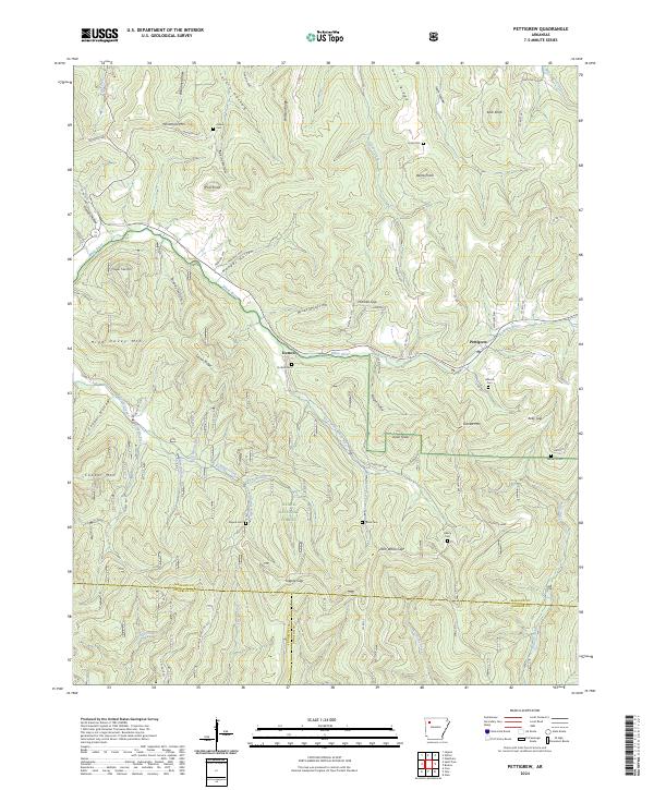
2024 Map of Pettigrew
USGS Topo · Published 2024About this map
The White River and its upper tributaries carve through the steep topography of the Ozark National Forest along the border of Madison, Franklin, and Johnson counties. The settlement of Pettigrew serves as a local hub near the headwaters, while Dutton is situated further west along the main river channel. This portion of the Ozark highlands is characterized by a dense network of family-named ridges and hollows, including Watson Ridge, Horn Ridge, and Adkins Hollow, which suggest long-standing kinship ties to the land. Numerous small burial grounds, such as Adkins Cem, Kilgore Cem, and Liberty Cem, are found near these drainages and gap passes like John White Gap and Kilgore Gap. The terrain's complexity is defined by prominent peaks including Whittmore Mtn, Garrett Mtn, and Isaac Knob, illustrating the difficult landscape through which early roads like Co RD 152 were established.
Find a feature on this map
64 named features on this map. Tap any name to fly to it.
Don’t see what you’re looking for? This feature index may not catch every label — zoom into the map to look around manually.
Map Details
Editions of this 2024 Pettigrew Map
This is the sole edition of this map. No revisions or reprints were ever made.
Other maps of this area

1879 · Cravens
USGS Topo · 1:62,500

1887 · Watalula
USGS Topo · 1:62,500

1906 · Batson
USGS Topo · 1:62,500

1939 · Watalula
USGS Topo · 1:62,500

1943 · St. Paul
USGS Topo · 1:62,500

1946 · St. Paul
USGS Topo · 1:62,500

1956 · Russellville
USGS Topo · 1:250,000

1964 · Russellville
USGS Topo · 1:250,000
1973 · Witter
USGS Topo · 1:24,000
1973 · Boston
USGS Topo · 1:24,000