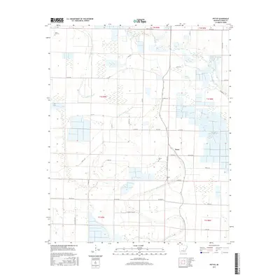
2017 Map of Pettus
USGS Topo · Published 2017About this map
The low-lying agricultural plains of southern Lonoke County are defined by a complex network of slow-moving waterways and drainage systems. Centered on the community of Pettus, the landscape is partitioned by the winding courses of Bakers Bayou and Bayou Meto, with Brushy Slough and Caney Cr further shaping the local hydrology. This 2017 survey reflects a deeply rooted rural infrastructure, where family and place-name roads like Tankersly Farm Rd, Bill Bryant Rd, and Bob Long Rd provide access to the extensive field systems. For those researching local lineages, the map identifies several key burial grounds, including Green Olive Cem in the northwest and both Sullivan Cem and Weedon Cem situated near the intersection of Pettus Rd and Weeden Cemetary Road. The arrangement of these cemeteries and naming conventions of the road network illustrate a long-standing pattern of family-centered land ownership in this part of Arkansas.
Find a feature on this map
42 named features on this map. Tap any name to fly to it.
Don’t see what you’re looking for? This feature index may not catch every label — zoom into the map to look around manually.
Map Details
Editions of this 2017 Pettus Map
This is the sole edition of this map. No revisions or reprints were ever made.
Other maps of this area

1891 · Little Rock
USGS Topo · 1:125,000

1893 · Little Rock
USGS Topo · 1:125,000

1937 · England
USGS Topo · 1:48,000

1939 · Keo
USGS Topo · 1:31,680

1940 · Lonoke
USGS Topo · 1:62,500

1941 · Keo
USGS Topo · 1:31,680

1942 · Scott
USGS Topo · 1:31,680

1943 · England
USGS Topo · 1:62,500

1943 · Jacksonville
USGS Topo · 1:31,680

1948 · Helena
USGS Topo · 1:250,000