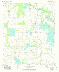
1982 Map of Pettus
USGS Topo · Published 1982About this map
Bakers Bayou and Meto Bayou dominate this landscape in Lonoke County, defining a region where water management and agriculture are deeply intertwined. The map reveals an extensive network of fish farms and irrigation features, including numerous siphons and an unnamed ditch system that supports the local economy. The settlement of Pettus serves as a central point, flanked by smaller communities like Oldham. This 1980s landscape is characterized by its transition from the natural drainage of Brushy Slough and Crooked Creek to a highly engineered agricultural environment. Several rural spiritual and commemorative sites are preserved here, including Green Olive Cem, Sullivan Cem, and Weedon Cem, alongside various country churches such as New Zion Ch and Bishops Chapel, providing valuable touchpoints for genealogists and local historians studying the rural Arkansas delta.
Find a feature on this map
28 named features on this map. Tap any name to fly to it.
Don’t see what you’re looking for? This feature index may not catch every label — zoom into the map to look around manually.
Map Details
Editions of this 1982 Pettus Map
This is the sole edition of this map. No revisions or reprints were ever made.
Other maps of this area

1891 · Little Rock
USGS Topo · 1:125,000

1893 · Little Rock
USGS Topo · 1:125,000

1937 · England
USGS Topo · 1:48,000

1939 · Keo
USGS Topo · 1:31,680

1940 · Lonoke
USGS Topo · 1:62,500

1941 · Keo
USGS Topo · 1:31,680

1942 · Scott
USGS Topo · 1:31,680

1943 · England
USGS Topo · 1:62,500

1943 · Jacksonville
USGS Topo · 1:31,680

1948 · Helena
USGS Topo · 1:250,000