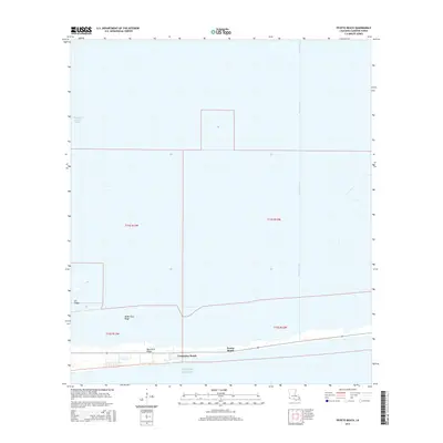
2015 Map of Peveto Beach
USGS Topo · Published 2015About this map
Constance Beach and Peveto Beach sit on the narrow coastal strip of Cameron Parish, where the Louisiana mainland meets the Gulf of Mexico. This low-lying landscape is defined by its chenier ridges—natural elevations that run parallel to the shoreline—including Blue Buck Ridge, McDermott Ridge, and Eli Ridge. These ridges provided the only reliable dry ground for settlement and transportation in an area otherwise dominated by wetlands and man-made waterways like the Beach Canal and Magnolia Vacuum Canal. State Highway 82 provides the primary transit link, following the natural curve of the coast. The map illustrates the precarious relationship between these small beachfront communities and the surrounding marsh, showing how local geography is dictated by the subtle elevation of the ridges and the extensive drainage network required to manage the coastal waters.
Find a feature on this map
15 named features on this map. Tap any name to fly to it.
Don’t see what you’re looking for? This feature index may not catch every label — zoom into the map to look around manually.
Map Details
Editions of this 2015 Peveto Beach Map
This is the sole edition of this map. No revisions or reprints were ever made.
Other maps of this area

1934 · Johnsons Bayou
USGS Topo · 1:24,000

1934 · Holly Beach
USGS Topo · 1:24,000

1934 · Peveto Beach
USGS Topo · 1:24,000

1934 · Greens Bayou
USGS Topo · 1:24,000

1934 · Browns Lake
USGS Topo · 1:24,000

1934 · Five Lakes
USGS Topo · 1:24,000

1935 · Peveto Beach
USGS Topo · 1:31,680

1935 · Five Lakes
USGS Topo · 1:31,680

1935 · Holly Beach
USGS Topo · 1:31,680

1935 · Browns Lake
USGS Topo · 1:31,680