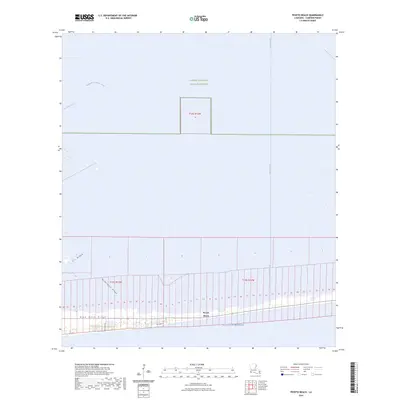
2024 Map of Peveto Beach
USGS Topo · Published 2024About this map
Peveto Beach sits along the shoreline where the Gulf of Mexico meets the coastal marshes of Cameron Parish. This landscape is defined by its narrow, linear ridges—elevated landforms that run parallel to the coast—including Blue Buck Ridge, McDermott Ridge, and Eli Ridge. These features provided rare stable ground for early habitation and travel in the wetlands. Significant portions of the northern map area are protected within the Sabine National Wildlife Refuge, where a network of waterways like the Magnolia Vacuum Canal and Beach Canal cut through the marsh. The map shows the coastal road network, including Gulf View Rd and Richard Ln, which provide access to the small residential pockets clinging to the strip of sand and shell between the ridges and the sea.
Find a feature on this map
57 named features on this map. Tap any name to fly to it.
Don’t see what you’re looking for? This feature index may not catch every label — zoom into the map to look around manually.
Map Details
Editions of this 2024 Peveto Beach Map
This is the sole edition of this map. No revisions or reprints were ever made.
Other maps of this area

1934 · Johnsons Bayou
USGS Topo · 1:24,000

1934 · Holly Beach
USGS Topo · 1:24,000

1934 · Peveto Beach
USGS Topo · 1:24,000

1934 · Greens Bayou
USGS Topo · 1:24,000

1934 · Browns Lake
USGS Topo · 1:24,000

1934 · Five Lakes
USGS Topo · 1:24,000

1935 · Peveto Beach
USGS Topo · 1:31,680

1935 · Five Lakes
USGS Topo · 1:31,680

1935 · Holly Beach
USGS Topo · 1:31,680

1935 · Browns Lake
USGS Topo · 1:31,680