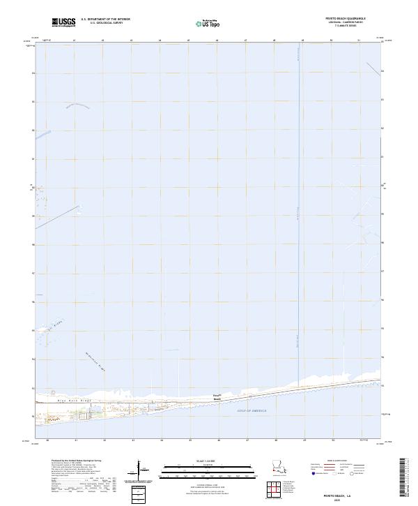
2025 Map of Peveto Beach
USGS Topo · Published 2025About this map
Peveto Beach sits along the shoreline of the Gulf of America, defined by a series of prominent coastal ridges and industrial waterways in Cameron Parish. The terrain is marked by distinct topographical rises including Eli Ridge, McDermott Ridge, and Blue Buck Ridge, which run roughly parallel to the coast. These ridges provide the primary structural foundation for local settlement and access in an otherwise low-lying marsh landscape. The drainage and movement of water across this coastal zone are managed through significant engineered features such as the Magnolia Vacuum Canal and the Beach Canal. Local transit is confined to the immediate coastal strip, with Gulf View Rd and Richard Ln serving the residential and commercial interests of the beach community. The arrangement of these ridges and canals illustrates the ongoing balance between human habitation and the hydrology of the Louisiana gulf coast.
Find a feature on this map
9 named features on this map. Tap any name to fly to it.
Don’t see what you’re looking for? This feature index may not catch every label — zoom into the map to look around manually.
Map Details
Editions of this 2025 Peveto Beach Map
This is the sole edition of this map. No revisions or reprints were ever made.
Other maps of this area

1934 · Johnsons Bayou
USGS Topo · 1:24,000

1934 · Holly Beach
USGS Topo · 1:24,000

1934 · Peveto Beach
USGS Topo · 1:24,000

1934 · Greens Bayou
USGS Topo · 1:24,000

1934 · Browns Lake
USGS Topo · 1:24,000

1934 · Five Lakes
USGS Topo · 1:24,000

1935 · Peveto Beach
USGS Topo · 1:31,680

1935 · Five Lakes
USGS Topo · 1:31,680

1935 · Holly Beach
USGS Topo · 1:31,680

1935 · Browns Lake
USGS Topo · 1:31,680