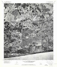
1975 Map of Peveto Beach
USGS Topo · Published 1976About this map
Peveto Beach defines the southern edge of this coastal landscape, situated along the shoreline of the Gulf of Mexico. This 1975 orthophotoquad provides a clear visual record of the marshlands and complex hydrologic patterns characteristic of Cameron Parish before later coastal changes. The winding course of Old North Bayou and Old East Bayou cut through the terrain, revealing the natural drainage patterns and brackish ecosystems of the Louisiana gulf coast. The photographic imagery captures the distinct vegetation and soil signatures of the region, offering a precise look at the land's surface as it existed in the mid-1970s. This specific survey is an essential document for understanding the coastal geomorphology and environmental history of this stretch of beach and bayou.
Find a feature on this map
4 named features on this map. Tap any name to fly to it.
Don’t see what you’re looking for? This feature index may not catch every label — zoom into the map to look around manually.
Map Details
Editions of this 1975 Peveto Beach Map
This is the sole edition of this map. No revisions or reprints were ever made.
Other maps of this area

1934 · Johnsons Bayou
USGS Topo · 1:24,000

1934 · Holly Beach
USGS Topo · 1:24,000

1934 · Peveto Beach
USGS Topo · 1:24,000

1934 · Greens Bayou
USGS Topo · 1:24,000

1934 · Browns Lake
USGS Topo · 1:24,000

1934 · Five Lakes
USGS Topo · 1:24,000

1935 · Peveto Beach
USGS Topo · 1:31,680

1935 · Five Lakes
USGS Topo · 1:31,680

1935 · Holly Beach
USGS Topo · 1:31,680

1935 · Browns Lake
USGS Topo · 1:31,680