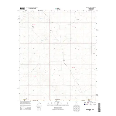
2013 Map of Phantom Banks
USGS Topo · Published 2013About this map
Phantom Banks defines the lower half of this landscape in southeast Eddy Co, where the High Plains terrain is etched by drainage channels and punctuated by essential water catchments. The presence of Steeple Ranch and several functional landmarks, such as Target Windmill and Gyp Windmill, indicates a land managed for ranching and resource extraction. A sparse network of unpaved corridors, including Buck Jackson Rd and various service paths like Pipeline Rd, provides the primary access through this arid environment.
Find a feature on this map
22 named features on this map. Tap any name to fly to it.
Don’t see what you’re looking for? This feature index may not catch every label — zoom into the map to look around manually.
Map Details
Editions of this 2013 Phantom Banks Map
This is the sole edition of this map. No revisions or reprints were ever made.
Other maps of this area

1925 · Orla 2-b
USGS Topo · 1:48,000

1931 · Orla
USGS Topo · 1:62,500

1954 · Hobbs
USGS Topo · 1:250,000

1954 · Pecos
USGS Topo · 1:250,000

1957 · Pecos
USGS Topo · 1:250,000

1958 · Hobbs
USGS Topo · 1:250,000
1968 · Pierce Canyon
USGS Topo · 1:24,000

1968 · Orla NE
USGS Topo · 1:24,000
1968 · Red Bluff
USGS Topo · 1:24,000

1968 · Phantom Banks
USGS Topo · 1:24,000