2022 Map of Pharr
USGS Topo · Published 2022About this map
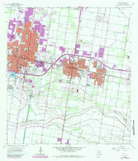
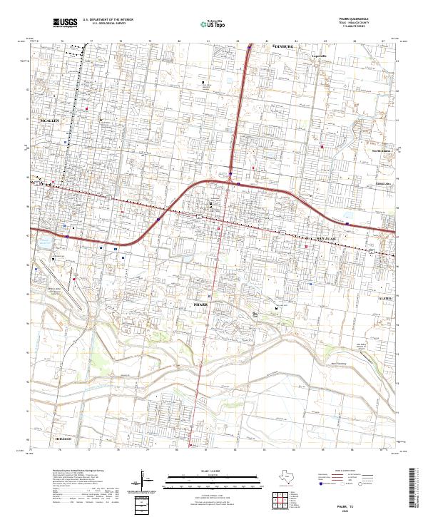
Pharr and San Juan anchor this dense urban grid in the Rio Grande Valley, where modern residential development tightly borders established agricultural infrastructure. The landscape is defined by the vital management of water, featuring the McAllen Main Canal, Boeye Reservoir, and the prominent Main Floodway cutting through the southern fields toward Hidalgo. This 2022 survey captures the region's character as a major transportation and aviation hub, showing the expansive McAllen Miller International Airport and the smaller Mid-Valley Dusters Inc Airport. Genealogists will find several significant burial sites across the quadrangle, including the Palm Valley Memorial Gardens, Roselawn Cem, and the dual sections of Guadalupe Cem - North and Guadalupe Cem - South. Residential growth is evident in newer neighborhoods like Lopezville and North Alamo, which fill the spaces between the historic city centers and the irrigation networks.
Find a feature on this map
169 named features on this map. Tap any name to fly to it.
Don’t see what you’re looking for? This feature index may not catch every label — zoom into the map to look around manually.
Map Details
Editions of this 2022 Pharr Map
This is the sole edition of this map. No revisions or reprints were ever made.