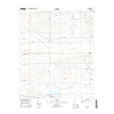
2015 Map of Pheba
USGS Topo · Published 2015About this map
The town of Pheba serves as the primary hub in this portion of the Mississippi Black Prairie region, situated at the junction of Pheba 4 St and several rural routes. The landscape is defined by a dense network of watercourses, including the westward-flowing Sun Cr and Double Cabin Cr, which carve through the terrain between the Clay and Oktibbeha county line. Further south, the expansive Oktibbeha County Lake anchors the residential developments of Lakeside Estates and Waterfront Estates, illustrating the shift from traditional agricultural use to lakeside community planning.
Find a feature on this map
65 named features on this map. Tap any name to fly to it.
Don’t see what you’re looking for? This feature index may not catch every label — zoom into the map to look around manually.
Map Details
Editions of this 2015 Pheba Map
This is the sole edition of this map. No revisions or reprints were ever made.
Other maps of this area

1953 · West Point
USGS Topo · 1:250,000

1958 · West Point
USGS Topo · 1:250,000

1959 · Pheba
USGS Topo · 1:62,500

1963 · West Point
USGS Topo · 1:250,000

1965 · Starkville
USGS Topo · 1:24,000

1965 · Longview
USGS Topo · 1:24,000

1972 · Maben
USGS Topo · 1:24,000

1972 · Mantee
USGS Topo · 1:24,000

1972 · Double Springs
USGS Topo · 1:24,000

1982 · West Point
USGS Topo · 1:100,000