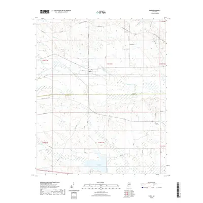
2020 Map of Pheba
USGS Topo · Published 2020About this map
Pheba sits at the heart of this survey of the Clay and Oktibbeha county line, where a network of rural roads such as N Maben Bell Schoolhouse Rd and Polly Bell Rd trace family landholdings and historic access routes. The landscape is defined by the winding paths of Double Cabin Cr and Sun Cr in the north, while the southern portion is dominated by the sprawling waters of Oktibbeha County Lake. For those tracing local family histories, several burial grounds are documented, including Mount Zion Cem and Pearsons Chapel Cem. The drainage patterns of the area are complex, featuring numerous named branches and creeks like Biba Wila Cr and Bu-Wu Cr, illustrating the watershed's influence on the local road grid and settlement patterns.
Find a feature on this map
59 named features on this map. Tap any name to fly to it.
Don’t see what you’re looking for? This feature index may not catch every label — zoom into the map to look around manually.
Map Details
Editions of this 2020 Pheba Map
This is the sole edition of this map. No revisions or reprints were ever made.
Other maps of this area

1953 · West Point
USGS Topo · 1:250,000

1958 · West Point
USGS Topo · 1:250,000

1959 · Pheba
USGS Topo · 1:62,500

1963 · West Point
USGS Topo · 1:250,000

1965 · Starkville
USGS Topo · 1:24,000

1965 · Longview
USGS Topo · 1:24,000

1972 · Maben
USGS Topo · 1:24,000

1972 · Mantee
USGS Topo · 1:24,000

1972 · Double Springs
USGS Topo · 1:24,000

1982 · West Point
USGS Topo · 1:100,000